|
              
THE PIERRE-St-MARTIN
MASSIF IN 3D
A virtual visit
  Visit the Anialarra lapiaz, and fly through and over
it in 3D, following the trace of the cave system (green or blue)
What do you need?
- Google Earth versie 3 -you
can download it here
Warning: you need a recent and powerful computer with a modern Graphics
adapter
DO NOT download Google 4 Beta - time being, it can not handle large
image overlays
- The image overlays of the area (file Anialarra.kmz).
It consists out of a giant satellite photo (over 100 screenprints, manually stiched together in Photoshop), a detailed map of the area, and
some placemarks. Download
the file here (13 MB). Save it on your computer. If
the file wants to save itself as Anialarra.zip,
rename it afterwards into Anialarra.kmz !!
And then?
Open the file Anialarra.kmz in Google Earth 3 (or double-click it).
Warning: it might take a few minutes for Google Earth to load the file,
it is quite big! AGAIN: Google Earth 4 Beta can not handle
it!
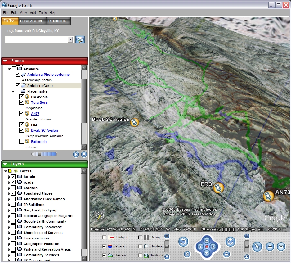
At the left, in the "Places" window, there will be a folder "Anialarra"
(under Temporary Places) containing:
- an image overlay "Anialarra Photo Aerienne", and an image overlay "Anialarra
Carte". When you highlight an image overlay, a small slider will
appear at the bottom of the Places Window. Use it to adjust the
transparency of the images. On the map, the cave trace is shown in
green (Anialarra System) or blue (FR3 and other caves)
- some placemarks like Pic d'Anie. Double-click them to fly to them.
Do use the 3D vision of Google Earth! Press down the scroll
wheel of your mouse and move the mouse.
Enjoy!
|